
7 Day Forecast
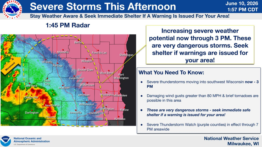
The National Weather Service has issued a severe thunderstorm warning until 3 p.m. for most of Dane County, with straight-line winds possible.
Tornadoes are still possible, and the National Weather Service called this a dangerous storm and urged people to take shelter if a warning is issued in their area.
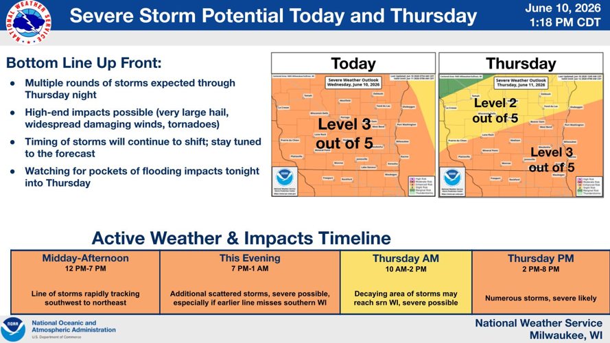
The first in multiple rounds of severe storms over the next two days for southern Wisconsin hit Wednesday afternoon, according to forecasters.
About 10,000 Madison Gas and Electric customers and upwards of 40,000 Alliant Energy customers in Wisconsin were without power shortly after the initial storms passed, the utilities’ outage maps showed.
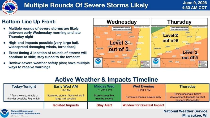
The Weather Service Storm Prediction Center has placed southern Wisconsin under an “Enhanced Risk” — the third of five levels, with five being the highest threat — for severe weather Wednesday and Thursday.
People are also reading…
This means numerous severe storms are possible, with a few being intense, and large hail, damaging winds, and tornadoes possible at times.

The highest threat of severe weather will be Wednesday afternoon and again Thursday afternoon, with all types of hazardous weather possible, including tornadoes and winds up to 80 mph, National Weather Service meteorologist Marcia Cronce said.
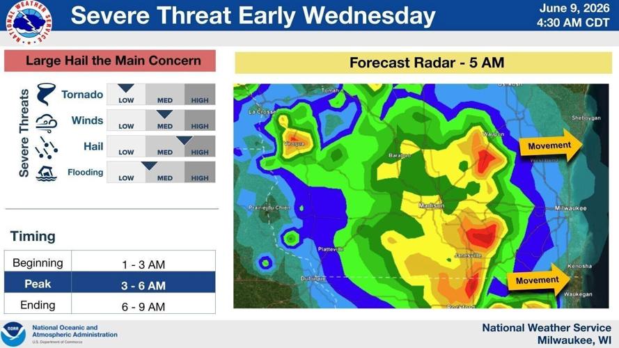
That threat has increased because no storms developed Wednesday morning.
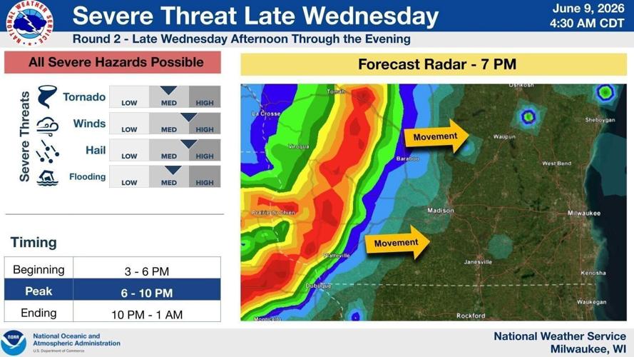
In the Madison area, the first round of storms was expected between noon and 7 p.m., and the next round is expected between 7 p.m. and 1 a.m.
The later round of storms Wednesday evening is less likely to be severe but will begin to produce a flood risk.
On Thursday, a decaying area of storms that also are less likely to be severe may move into southern Wisconsin around mid-morning.

The severe threat increases again Thursday from 2 p.m. to 8 p.m., with numerous storms expected and a high threat of severe storms, especially south of Interstate 94 and if the morning round of storms does not linger. All hazards are possible, including tornadoes.
Chances for showers and storms for Madison are 60% Wednesday and Wednesday night, 90% Thursday, 80% Thursday night, 40% Saturday, 60% Saturday night, 20% Sunday night through Monday night, and 40% Tuesday.
Possible rain totals include a half to three-quarters of an inch Wednesday, a quarter to a half of an inch Wednesday night, three quarters of an inch to an inch Thursday, a quarter to a half of an inch Thursday night and again Saturday night.
Highs for Madison Wednesday through Tuesday should be near 87, 84, 80, 83, 73, 72 and 74, and overnight lows around 67, 57, 61, 56, 52 and 53.
Madison has seen 16.68 inches of precipitation this year, 2 inches ahead of normal.