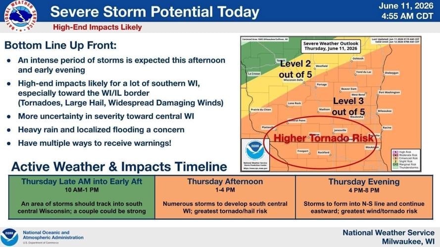
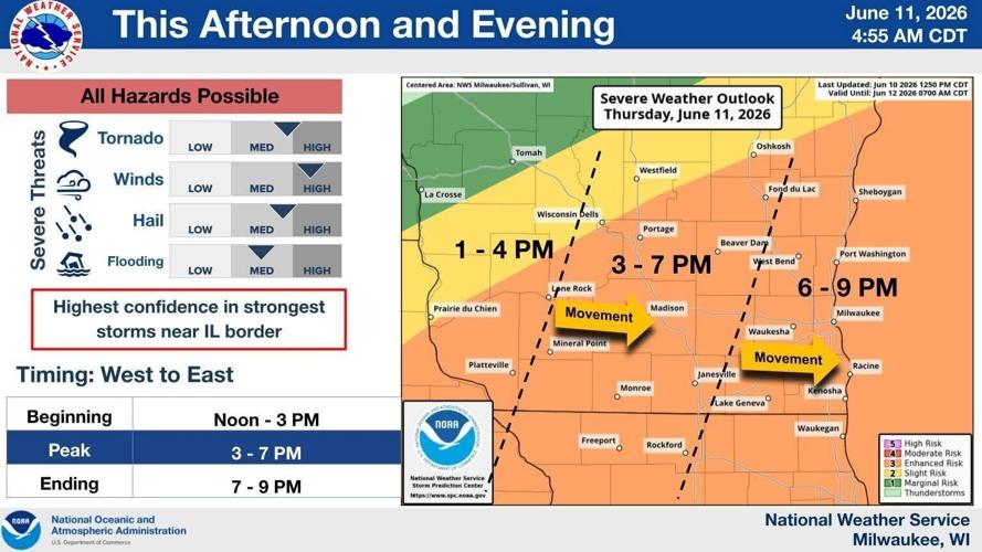
A line of weaker storms could move across the area in the late morning to early afternoon, but the intense storms are expected between 3 p.m. and 7 p.m., National Weather Service meteorologist Marcia Cronce said in a statement.
NATIONAL WEATHER SERVICE
All hazards are possible with high-end impacts, from tornadoes to widespread damaging winds to large hail to flash flooding.
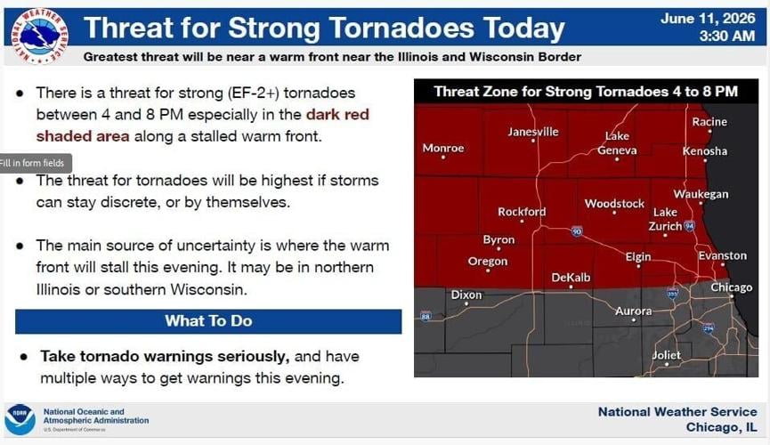
The risk for tornadoes is highest from 4 p.m. to 8 p.m. in far southern Wisconsin and northern Illinois, with strong tornadoes of EF2 scale or higher possible.
The tornado threat is highest if storms stay isolated, rather than in a line, and the biggest source of uncertainty is where the warm front stalls this evening: southern Wisconsin or northern Illinois.
NATIONAL WEATHER SERVICE
Chances for showers and storms for Madison are 90% Thursday, 80% Thursday night, 60% Saturday and Saturday night, 20% Monday and Monday night, and 30% Tuesday and Wednesday.
Possible rain totals include three quarters of an inch to an one inch Thursday, a tenth to a quarter of an inch Thursday night, and again Saturday night.
Highs for Madison Thursday through Wednesday should be near 80, 80, 81, 72, 73, 73 and 76, and overnight lows around 56, 61, 56, 52, 52 and 52.
The Dane County Regional Airport recorded 0.63 inches of rain on Wednesday, boosting Madison’s 2026 total to 17.31 inches, 2.45 inches above normal.