GREAT LAKES OBSERVING SYSTEM | NEW TOOLS OF DISCOVERY
Push to map Great Lakes bottom gains momentum amid promises effort will help fishing and shipping
TODD RICHMOND Associated Press
Updated
1 of 2
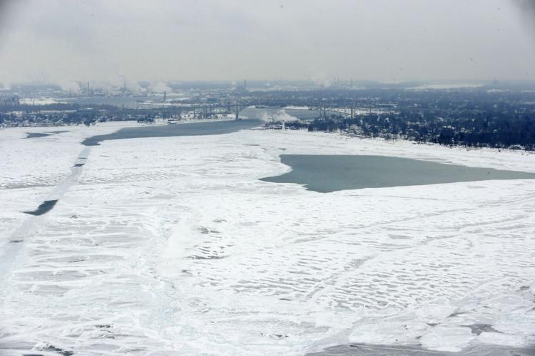
Lake Huron is shown, looking south towards Port Huron, Mich., right, and Sarnia, Ont., left. A marine scientist says an ambitious mapping project will pinpoint hundreds of underwater shipwrecks, illuminate topographical features and locate infrastructure.
CARLOS OSORIO, ASSOCIATED PRESS
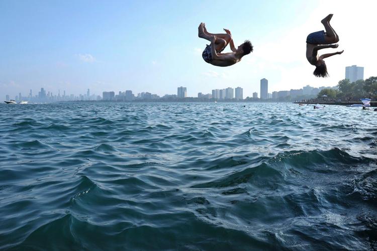
Teenagers plunge into Lake Michigan to cool off during an August heat wave at Montrose Beach in Chicago. Proponents of a Great Lakes mapping project say it would help ships avoid submerged hazards, identify fisheries and inform erosion, storm surge and flooding models.
Jennifer Boehme grew up scouting beaches around her home in St. Petersburg, Florida, for whatever she could find. Rocks, sand dollars, coquina mollusks — anything the ocean gave up.
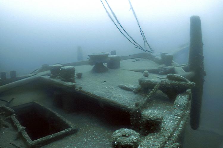
In this June 2021 image taken from video provided by the Thunder Bay National Marine Sanctuary, the bow of the Ironton is seen in Lake Huron off Michigan's east coast. The executive director of the Great Lakes Observing System is leading a campaign to map every meter of the lakes' bottom.
While more than 2,000 sets of duplicate ballots were mailed to voters in Madison, multiple safeguards are in place to flag and reject more tha…
In this June 2021 image taken from video provided by the Thunder Bay National Marine Sanctuary, the bow of the Ironton is seen in Lake Huron off Michigan's east coast. The executive director of the Great Lakes Observing System is leading a campaign to map every meter of the lakes' bottom.
Lake Huron is shown, looking south towards Port Huron, Mich., right, and Sarnia, Ont., left. A marine scientist says an ambitious mapping project will pinpoint hundreds of underwater shipwrecks, illuminate topographical features and locate infrastructure.
Teenagers plunge into Lake Michigan to cool off during an August heat wave at Montrose Beach in Chicago. Proponents of a Great Lakes mapping project say it would help ships avoid submerged hazards, identify fisheries and inform erosion, storm surge and flooding models.